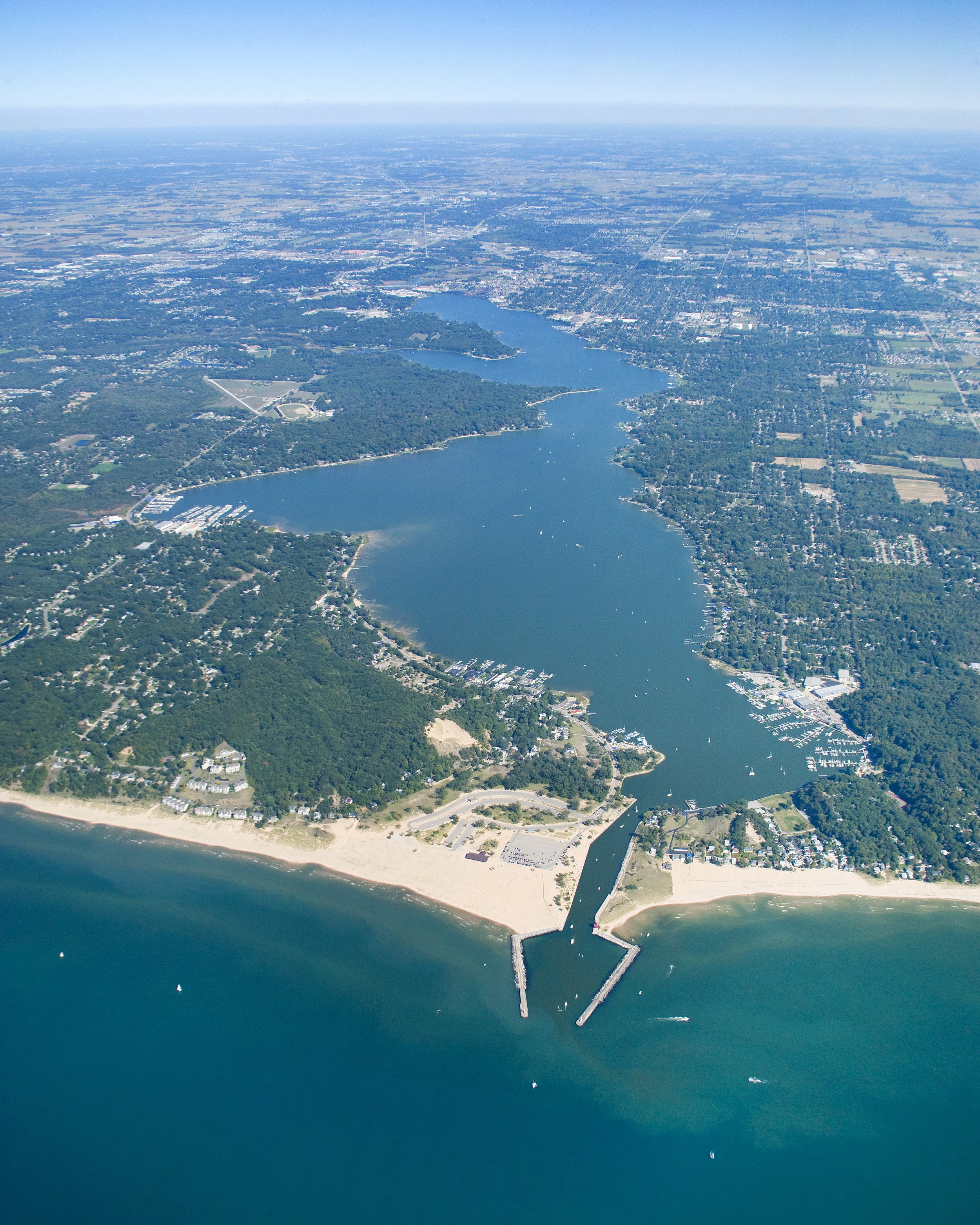
Macatawa Watershed
The Macatawa Watershed includes 175 square miles of land that drains to Lake Macatawa. Lake Macatawa’s water quality is impaired because too much sediment and phosphorus enters the lake. Rain water washes sediment and phosphorus off the land and into the lake through streams and the storm sewer system. Once in the lake, sediment can smother fish habitat and phosphorus can encourage algae and other plants to grow. This can lead to other problems that limits the lake’s ability to support healthy fish populations.
Working Toward Restoration
The MACC worked with local units of government and other community partners from 1996 to 2021 to improve water quality in Lake Macatawa. In October 2021, the responsibility of managing the Macatawa Watershed was transferred to the ODC Network. The overall goal in the Macatawa Watershed is to reduce sediment and phosphorus inputs into the lake to restore water quality and aquatic habitat.
In 1999, the US Environmental Protection Agency approved a total maximum daily load (TMDL) for phosphorus in Lake Macatawa. This document established a maximum amount of phosphorus that the lake can receive each year and still meet water quality standards that support fish and other aquatic life. The Macatawa Watershed Management Plan provides a road map for the actions we can take to reduce phosphorus. These actions include public education, policy changes and best management practices to prevent rain from washing away sediment and phosphorus. Progress is tracked and reported annually. The most recent reports are linked below.
Monitoring Progress
The TMDL recommends reducing annual phosphorus loads to the lake to no more than 55,000 pounds per year or an average concentration in the lake of 50 parts per billion. Since it is difficult to measure how much phosphorus actually enters the lake each year, we monitor the concentration of phosphorus in the lake to measure progress toward meeting this goal. Recent monitoring reports are available here.
Questions about the Macatawa Watershed? Contact Kelly Goward, Watershed Manager at the ODC Network: kelly@outdoordiscovery.org or 616-393-9453.
Documents
Macatawa Watershed Management Plan
Appendix A: Founding Documents
Appendix B: Information and Education Strategy
Appendix C: Road Stream Crossing Report (large file - available upon request)
Appendix D: Annual TMDL Report 2010-2011
Appendix E: Water Quality Criteria
Appendix F: Excerpt from 2010 Integrated Report
Appendix G: 2006, 2008 and 2010 DEQ Monitoring Reports
Appendix H: Pollutants, Sources and Causes
Appendix I: 2009 DEQ Hydrology Study
Appendix J: 2009 DEQ Pollutant Loading Study
Appendix L: Macatawa Geomorphology Assessment
Appendix M: Critical Area Analysis
Appendix N: Natural Land Protection Model
Appendix O: Estimated Load Reductions
Appendix P: Milestones, Schedule and Costs
Appendix Q: MDEQ Wetlands Study
Appendix R: 2002 and 2010 Agriculture Inventory
Appendix S: Farmland Protection Study
Appendix U: Management Indicators
Appendix V: Sediment Studies (Approved July 2013)


